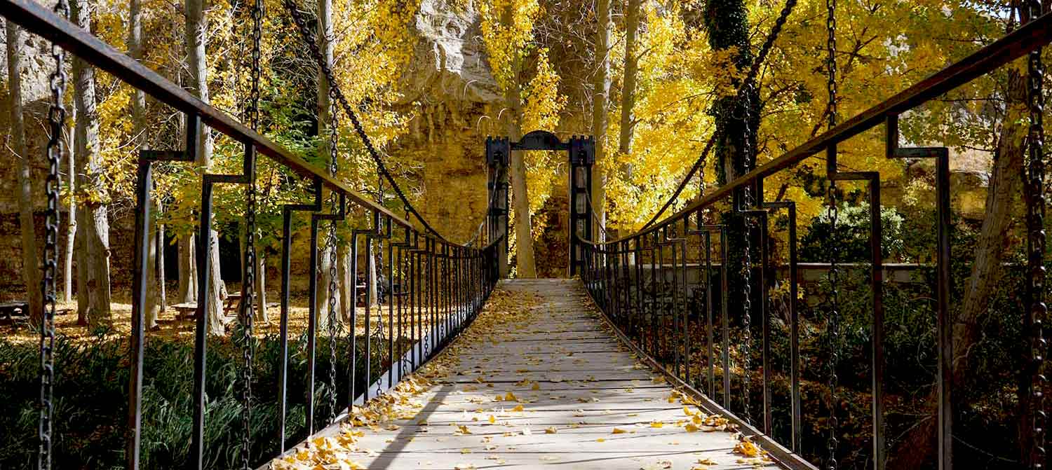
The Riverside Path along the Guadalaviar River is a fantastic circular route at the foot of Albarracín. A simple but fun route with stretches of stone paths, steps, hanging bridges and walkways. The path borders the city along the banks of the Guadalaviar river. On the route you will have a different view of Albarracín, the medieval walls and buttresses, the Torre Doña Blanca tower, the houses, as well as the orchards, water wheels and the Molino del Rey.
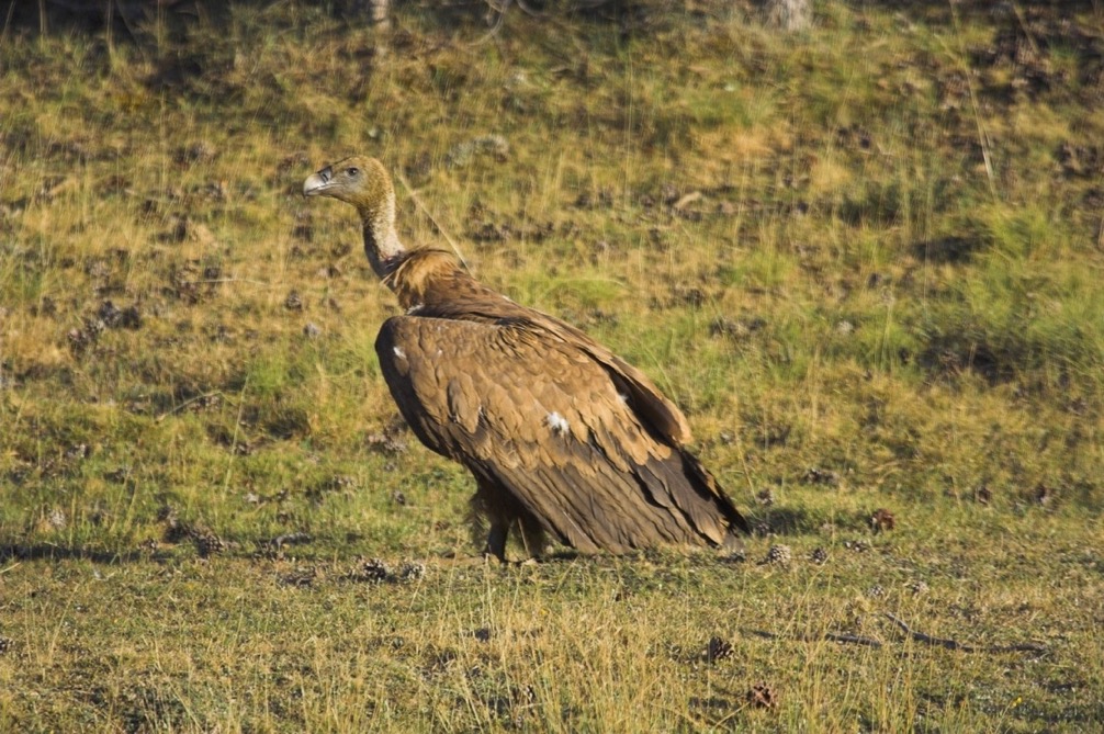
The Guadalaviar River is part of the image of the city of Albarracín; it runs through the canyon of the same river, an area where it is not uncommon to spot birds of prey such as the golden eagle, the Egyptian vulture and the Eurasian griffon vulture. The route can be completed by leaving the watercourse to walk along the upper part of a spectacular gorge that runs for more than 5 kilometres until you reach the junction of Royuela with the Torres de Albarracín.
The beginning of the Nature Trail is next to the tourist office, beside the Escolapios orchard, on an esplanade where there is an information panel where we will start the route.
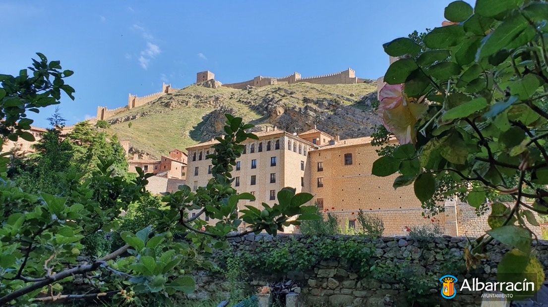
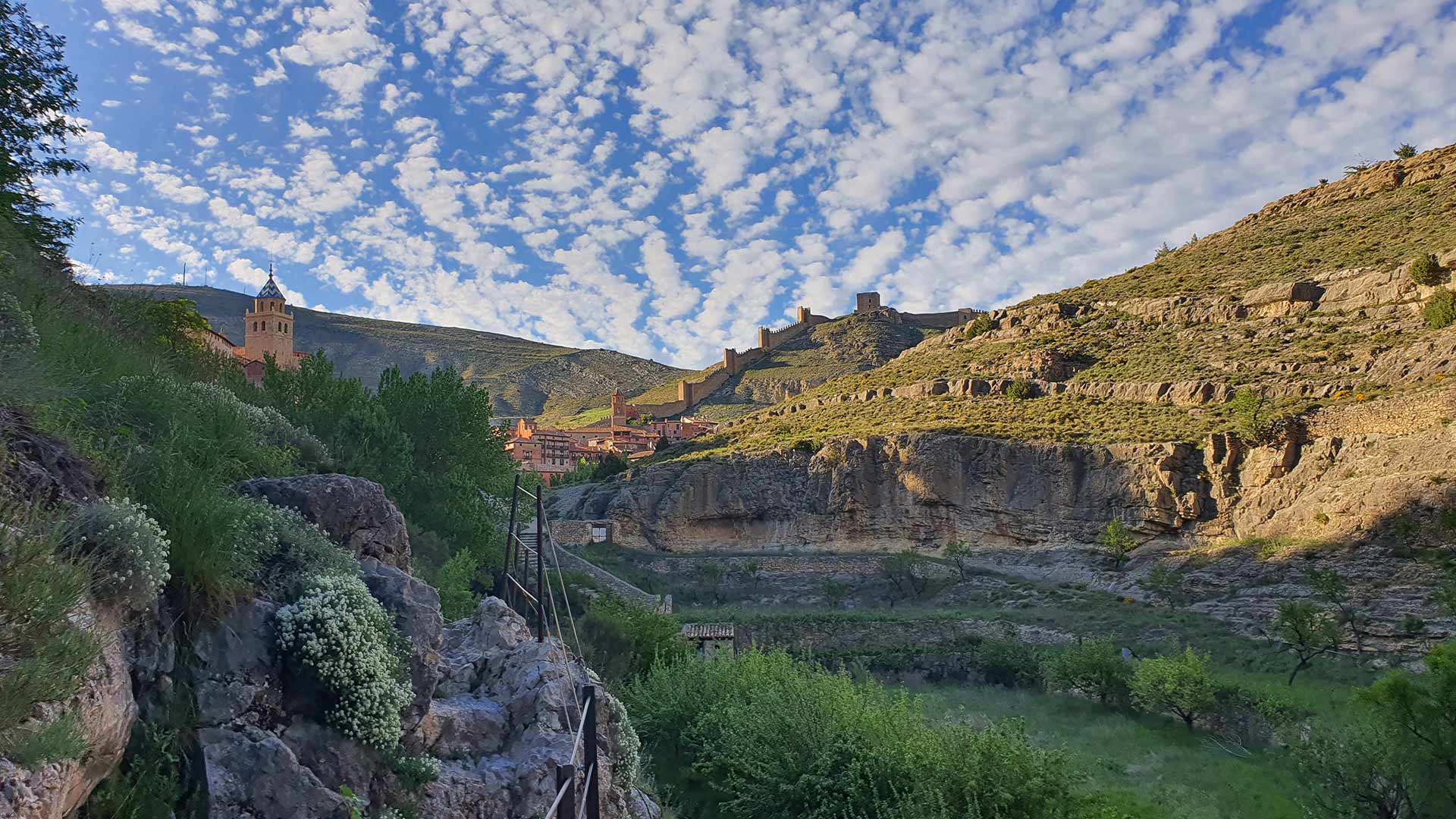
You will walk along a path parallel to the river, where opposite, before crossing the first bridge, you can see the city walls, with the Torre del Andador tower above that will guide you all the way, and just below the old Los Escolapios building.
Continuing along the bridge, start the first ascent on the path; in the background you can make out the cathedral with its Mudejar-style coloured roof tiles, the first hanging houses and Albarracín Municipal Park.
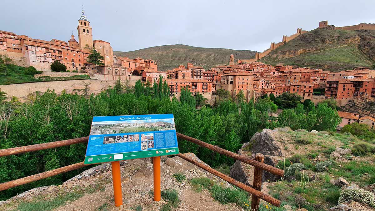
A little further along, where the path starts to zigzag, you can climb up to a fantastic viewpoint where there is an information panel to help you identify the different parts of the historical area.
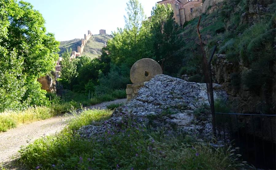
A little higher up there are some containment walls that were used during the Civil War. Following along the main path, you can admire all the meander of the river and part of Albarracín’s defence walls.
Albarracín was independent of the crowns of Aragón and Castile and was besieged over long periods of time; one of the longest was by Jaime I in 1220, which failed, when it came under attack for about six months. The chronicler Bernat Desclot refers to one of these conflicts, and speaks of the defensive system seen along the path we are going to travel.
“This city of Albarracín is between four kingdoms, namely: the kingdom of Aragón and the kingdom of Valencia and between the kingdom of Castile and Navarre, and it is surrounded entirely by high, wild mountains, and the city is nestled deeply between them and surrounded by a snow-fed river, so that no one can enter except via a very narrow place, and it is very well enclosed with strong walls and many towers”.
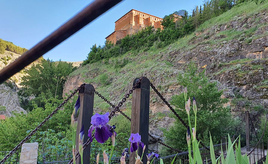
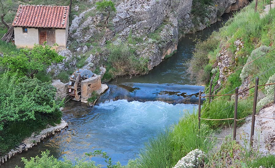
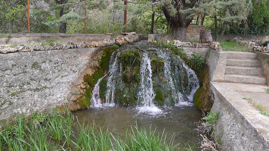
Below you can see the first water wheel that irrigates the municipal park via the channels, to the side a small path descends down to the park. Continue along the original path and a little further on you will come to Los Carneros bridge, which has been completely rebuilt. It was formerly the bridge that connected the Dominican convent (destroyed in the 18th century) and the Church of Santa Maria, patron saint of Albarracín.
From there, two branches emerge, one towards the Church of Santa Maria and the antigua nevera (old refrigerator) of Albarracín.
The other path leads to a stone-lined path and several walkways. You will see the water wheel known as Gorila y Kili alongside the remains of an ancient batan (room where the millstone was located).
The path runs through the limestone; you need to be careful not to slip. The path goes over the mountain, afterwards you will be suspended by the walkways with breathtaking views of the riverbed. Continue along the walkways, then you’ll enter what is commonly referred to as the Huerta Vieja (old orchard). The Guadalaviar river is home to many animal species and, with a little patience and attention, you’ll be able to spot some trout and lots of dragonflies.
You may also spot some rare species like the golden eagle and the Egyptian vulture. The existing nooks on either side of the river provide resting areas and roosts for the Eurasian griffon vulture. The alpine swift, the red-billed chough and the crow are easily spotted.
The existing space by the river has allowed dense riverside vegetation to develop, with good specimens of poplars (Populus nigra and Populus tremula), willows, ash and elms. The vertical river bank alignments are just able to maintain a scattered vegetation of gorse, rosemary and thyme.
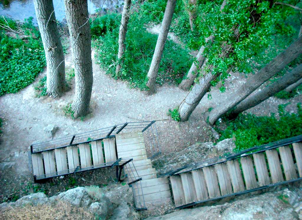
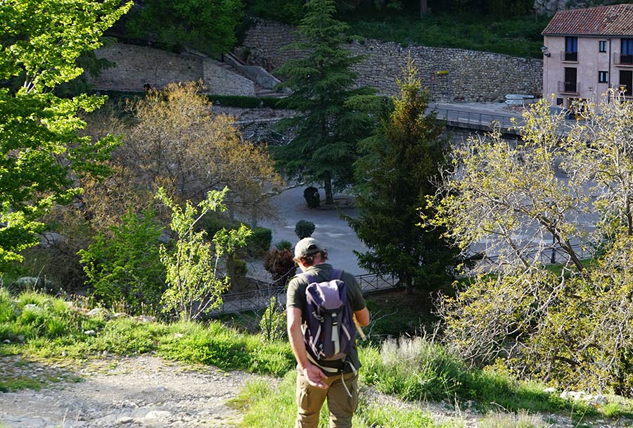
Descend down all the walkways and you will reach the Guadalaviar river; there are several uphill climbs if you want to leave the route to reach the old town of Albarracín heading towards the San Juan neighbourhood.
Continue along the path and you will see several bridges
leading to private farms, which are still active.
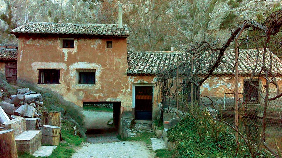
Afterwards you can admire the old Molino de Rey, the oldest mill in Albarracín; formerly a hydroelectric plant to supply the city with electricity, it is now a small fish farm, the first ecological fish farm in Spain (currently unused).
You are now at the end of the trail, where you head back up through the Portal del Agua (one of the city gates).
Recommendations:
To go on the riverside walk in Albarracín you’ll need a pair of comfortable walking shoes and suitable clothes (long trousers are best), since in some areas there are weeds that could scratch your skin.
Keep in mind that you will always feel cooler next to the river. Sun protection and a hat will be necessary in the summer, especially during the middle of the day.
It is also advisable to bring some type of mosquito repellent to avoid bites.