Natural Spaces
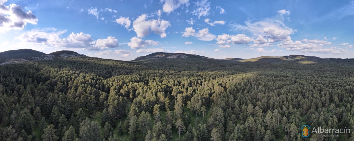
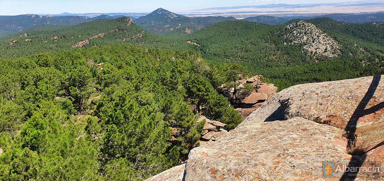
The Sierra de Albarracín, which is one of the country’s most famous destinations, offers numerous attractions with many unique, stunningly beautiful, natural enclaves, charming towns and villages and geological formations that breathe life into a large array of flora and fauna.
Albarracín is the perfect base for visiting the entire region and enjoying all the points of the Sierra de Albarracín mountains.
For nature lovers, for those travelling with families, for those seeking the grandeur of cultural heritage, for enjoying outdoor sport, or simply to relax and unwind like never before, the Sierra de Albarracín offers you plenty of spaces where you can find your passion.
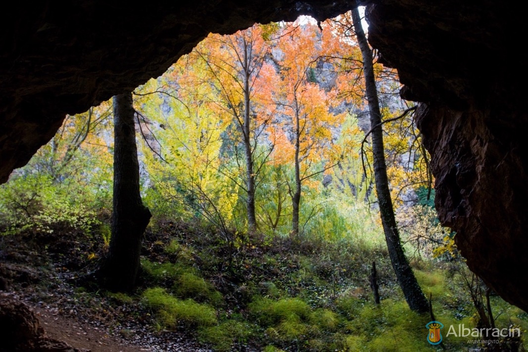
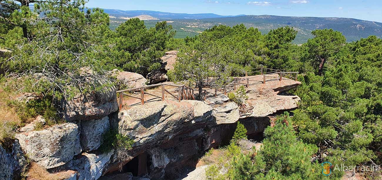
Undoubtedly one of the most complete, attractive places with the highest ecological and cultural value is the Protected Landscape of Los Pinares del Rodeno pine forests, where the enormous red sandstone rocks stand out, bringing a special life and uniqueness to this area of the mountain range with their capricious formations, all of it peppered with the ancient rock art inside the Cultural Park of Albarracín.
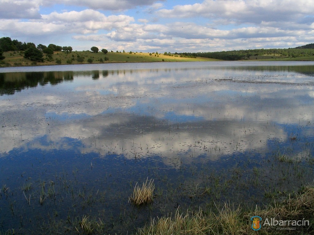
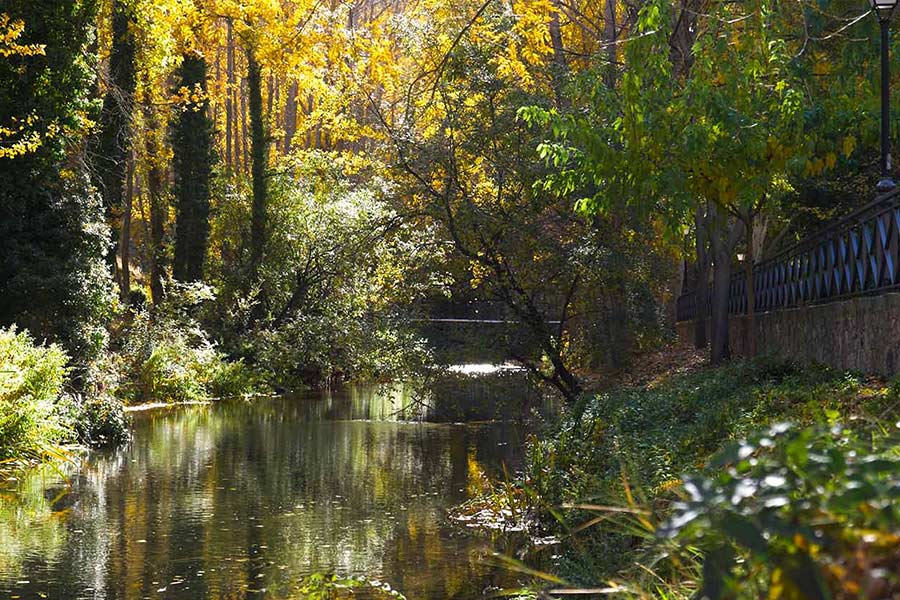
Inside the Sierra de Albarracín mountains you can also find waterfalls and rivers with impressive views, such as El Salto de San Pedro in el Vallecillo, or the Cascada de Calomarde, places where the water is the prevailing feature, without forgetting El Barranco Hondo and Los Ojuelos del Río Cabriel. Water also brings life to other areas, such as the lagoons, Laguna de Noguera, Laguna de Bezas and Laguna de Rubiales, all of which provide a habitat to numerous animal species.
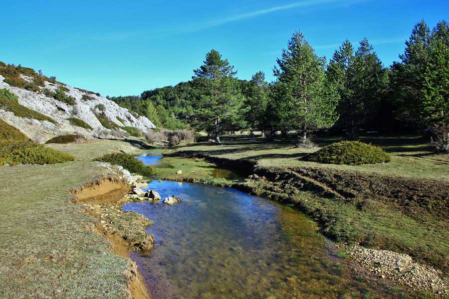
The Sierra de Albarracín is one of the areas on the Iberian Peninsula with the greatest number of springs and water sources. The source of the Tagus (Tajo) river is in the highest part of the mountain range, close to Frías de Albarracín. From there, it flows east, crossing the Vega del Tajo where it meets several tributaries, bordering the provinces of Cuenca and Guadalajara.
At a geological level, the Sierra de Albarracín offers diverse and attractive landscapes with different geological formations, from the aforementioned areas of red sandstone, to areas of sandstone, limestone and calcareous rock. Here it is worth highlighting places like stone runs, chasms and sinkholes that create spectacular places to visit and enjoy thanks to the depressions in their surfaces.
Places of Interest in the Fluvial Landscape
Cabriel River (Río Cabriel)
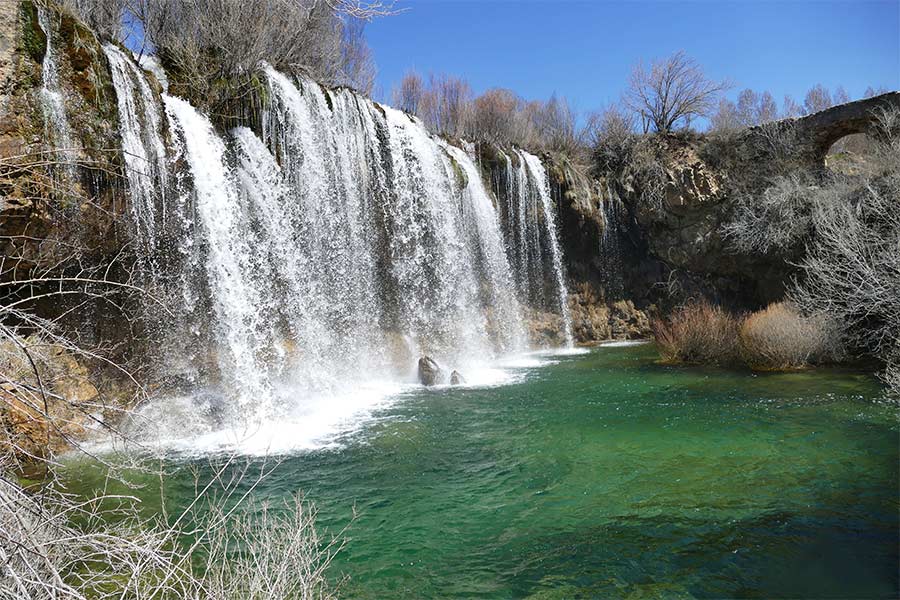
Salto del Molino de San Pedro
Region: Sierra de Albarracín
Municipality: Albarracín
From Albarracín, take the A-1703 towards Moscardón and Terriente. After passing through the latter, you will arrive at Toril on the A-2703. From here, a local road will take you to Masegoso and El Vallecillo. After crossing the Cabriel river and 2 kilometres before el Vallecillo, turn left onto an earth track that leads to Mas de San Pedro. After 300 metres you can park your vehicle and walk 200 metres in a south-westerly direction to view the river.
The waterfall, which is about 12 metres high, cascades down calcareous formations from the Upper Cretaceous series with strata sloped in the opposite direction to the river’s water flow, which increases the morphology of the waterfall. At the foot there is an enormous, deep pool of water, from which you can see the aqueduct that carried the water from the river to San Pedro mill.
The animal life connected to the river merits a special mention, with the presence of birds such as the wagtail and the dipper, which are intimately linked to the clean water rivers. In these areas, populations of otters exist, which are an excellent indicator of a well-preserved environment.
Worthy of note is the presence of a dense bank of willow, ash and poplar trees that contrast with the landscape of the environment dominated by Scots pine or sessile oaks and junipers, with hardly any undergrowth. Next to the mill there is a repopulated poplar grove. Close to the river there are abundant rushes and reedbeds, and in the rock the travertine walls are covered with moss.
Visual assessment: clear water.
Jucar River Basin Hydrological Plan: 1
Environmental objectives: very good condition (1).
The Protected Natural Spaces affected are:
Special Protection Areas for Birds (SPA) ES0000309 Montes Universales-Sierra de Albarracín
Site of Community Importance (SCI) ES2420138 Valdecabriel-Las Tejeras
Proximity to protection types:
Protected Landscape of Los Pinares de Rodeno de Albarracín.
SCI ES2420039 Rodeno de Albarracín.
SCI ES2420139 Alto Tajo and Muela de San Juan.
The Cabriel river is a tributary of the Júcar, which has its source in the Montes Universales in the so-called ‘Ojos de Cabriel’, a spring that can be accessed from the municipality of El Vallecillo.
Río Guadalaviar
Cañón Fluvial de Albarracín (from Masía del Perduto to Albarracín)
Region: Sierra de Albarracín
Municipality: Albarracín
From Teruel, head towards Zaragoza on the N-330 and take the turning to Albarracín on the A-1512. From Albarracín and following the signposted road to Tramacastilla, the river canyon runs parallel to the road and can be accessed easily at numerous points where there are small spaces available for parking.
The Guadalope river from its convergence with the Fuente del Berro river, reaches a significant flow and produces a canyon in limestone rock from the Early Jurassic period (Lias and Dogger) to Albarracín, where limestone and dolomites give rise to a narrow valley with vertical walls. The geological arrangement of the materials in subhorizontal strata with gentle folds makes the river continuously cut the same materials, resulting in very closed meandering patterns that the road follows throughout the route.
In addition to the singularity of the route through the bottom of the canyon is the presence of an abandoned meander of the Guadalaviar river. In fact, near Albarracín we can see an isolated farming area, with a semicircular shape formed by an old riverbed. An isolated rocky fragment marks the inner boundary of the ancient river flow.
Riverside environments such as this provide a habitat for significant species, such as the golden eagle and the Egyptian vulture. The existing nooks on both sides of the river provide resting areas and roosts for the Eurasian griffon vulture. The alpine swift, the red-billed chough and the crow are easily spotted.
The space by the river has allowed a dense riverside vegetation to develop with good specimens of poplars (Populus nigra and Populus tremula), willows, ash and elms. The vertical river bank alignments are just able to maintain a scattered vegetation of gorse, rosemary and thyme.
Current use: Community fishing reserve of the Regional Government of Aragón (DGA).
Visual assessment: clear water without any apparent pollution.
Jucar River Basin Hydrological Plan: 1
Environmental objectives: Good Condition (2 A).
The Protected Natural Spaces affected are:
Site of Community Importance (SCI) ES2420140 Estrechos del Guadalaviar.
Proximity to protection types:
Protected landscape of Los Pinares de Rodeno de Albarracín.
Special Protection Areas for Birds (SPA) ES0000309 Montes Universales-Sierra del Tremedal.
Site of Community Importance (SCI) ES2420039 Rodeno de Albarracín.
Tagus River (Río Tajo)
Ojos de Valdeminguete
Region: Sierra de Albarracín
Municipality: Albarracín
From Albarracín, take the A-1512 towards Tramacastilla; before you reach Torres de Albarracín take the A-1703, and before Royuela take a right turn to Calomarde and Frías de Albarracín. Continue along this road and you will reach the ‘official’ source of the Tagus river. At 7 kilometres, leave the Teruel-Cuenca road and turn right towards Guadalaviar, and after 1 kilometre follow the road on the left hand side of the Tagus signposted to Orea, Checa and Guadalajara. The springs are located at approximately 3 kilometres.
The source of the Tagus starts in a large valley, among meadows and pine trees. The geological structure of the area is defined by a Jurassic limestone formation (Puerto del Portillo) on Tertiary conglomerates and clays. The springs are located at the bottom of the valley, at the point where the thrust belt cuts into the topography. The ‘Ojos’ (eyes) are circular voids, typical of upstream water flows. Downstream, the Tagus enters Jurassic limestone formations, opening up a small pass.
The whole area is notable for its importance for nesting Mediterranean birds of prey. The calcareous walls allow the presence of rock birds such as the peregrine falcon and the Eurasian eagle-owl, and scavengers such as the Egyptian vulture and the common vulture. This area and the entire region of the Sierra de Albarracín in general is considered one of the European enclaves with the greatest diversity of lepidoptera (butterflies).
The characteristic vegetation of the area is the Scots pine, which appears scattered on the river bank and forms dense forests on the mountainous slopes along with isolated junipers. The bottom of the valley has green meadows where migrating cattle graze.
Visual assessment: clear water.
According to the Tagus River Basin Hydrological Plan:1
Environmental objectives: very good condition (1)
The Protected Natural Spaces affected are:
Special Protection Areas for Birds (SPA) ES0000309 Montes Universales – Sierra del Tremedal.
Site of Community Importance (SCI) ES2420139 Alto. Tajo and Muela de San Juan.
Los Montes Universales National Game Reserve
Proximity to protection types:
Alto Tajo Nature Reserve (Community of Castile/La Mancha).
SCI ES2420138 Valdecabriel – Las Tejerías.
La Muela de San Juan and Alto del Portillo form the Mediterranean/Atlantic watershed.
White River (Río Blanco)
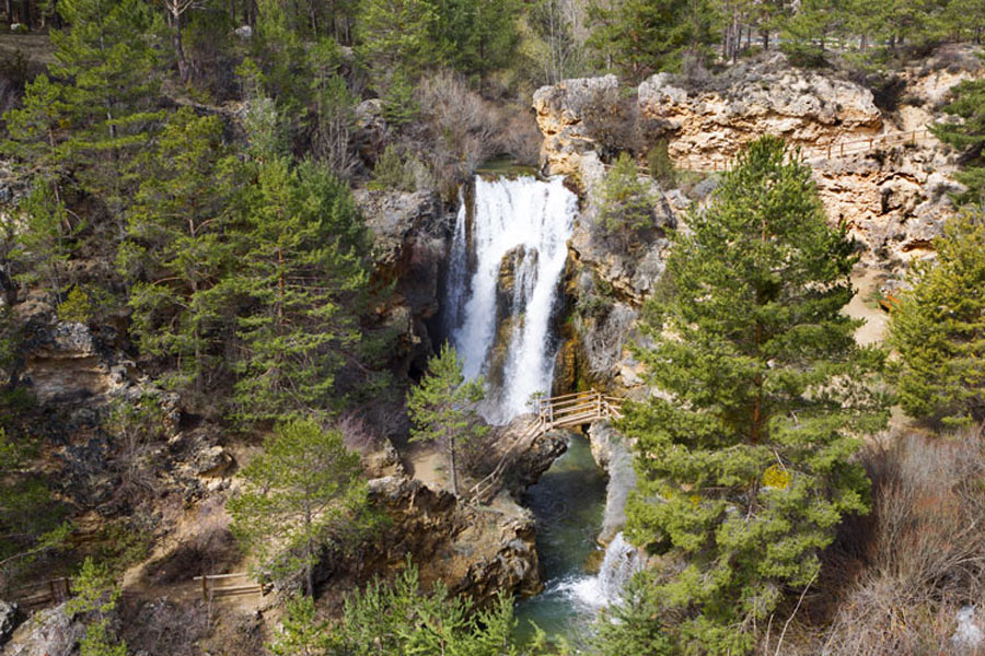
Calomarde Waterfall at the Fuente del Berro river
Region: Sierra de Albarracín
Municipality: Albarracín y Calomarde
From Teruel, drive to Albarracín on the A-1512 and continue in the direction of Tramacastilla, following the course of the Guadalaviar river. Before Torres de Albarracín, take the A-1703 and before you reach Royuela, turn right towards Calomarde. After 4 kilometres, you will arrive at a large car park from which signposted paths start both to the upper part as well as to the foot of the waterfall. The waterfall is visible from the car park.
It is a drop of about 20 metres, carved by La Fuente del Berro river in Jurassic limestone. The water falls into a deep pool lined with travertine deposits that currently continue to grow by a process of rapid precipitation of calcium carbonate. The river is the most important tributary of the Guadalaviar in the Sierra de Albarracín and has canyons of great scenic value both upstream and downstream of the town of Calomarde.
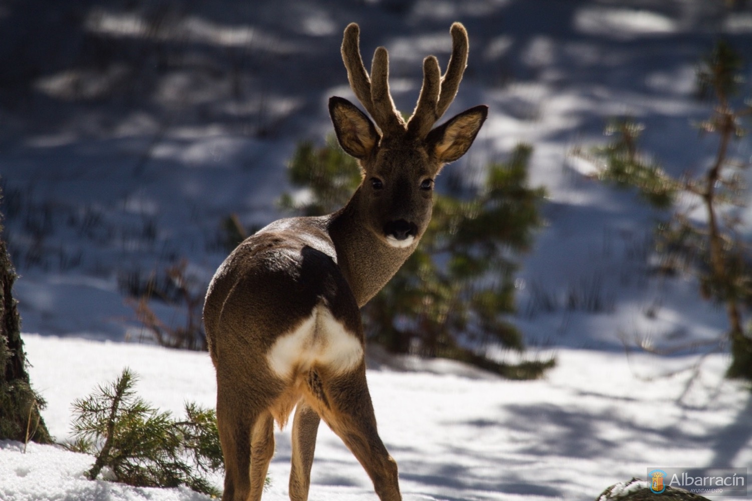
Most noteworthy in the area is the importance of the fauna linked to the forested areas, particularly pine forests, with a long list of birds that are not difficult to observe, such as the Eurasian nuthatch, the short-toed treecreeper, the cuckoo, the goldcrest and kinglet, the common blackbird, the true thrush and the citril finch. But the area’s emblematic fauna is the deer which, unlike the birds, is increasingly difficult to observe.
The environment around the waterfall is dominated by the presence of junipers and the Scots pine and the maritime pine, as well as interspersed oak trees creating mixed formations. These species descend down to the channel where they co-exist with riparian formations, such as bitter willows and poplars, in addition to reedbeds.
Visual assessment: clear water.
Jucar River Basin Hydrological Plan: 1
Environmental objectives: very good condition.
The Protected Natural Spaces affected are:
Special Protection Areas for Birds (SPA) ES0000309 Montes Universales-Sierra del Tremedal.
Proximity to protection types:
Protected Landscape of Los Pinares de Rodeno de Albarracín.
Site of Community Importance (SCI) ES2420039 Rodeno de Albarracín.
Site of Community Importance (SCI) ES2420140 Estrechos de Guadalaviar.
La Fuente del Berro river has two spectacular canyons. One canyon is located upstream, in the town of Calomarde, and another downstream from the waterfall mentioned. There are some spectacular rock formations, such as the natural bridge, called Rollo de Calomarde.
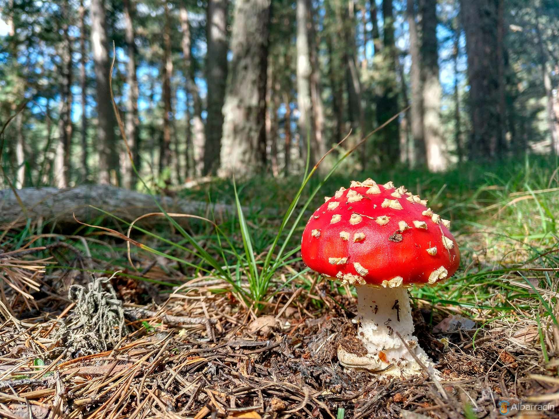
Mycology in the Mountain Range
The Albarracín Community Mycological Park inside the Sierra de Albarracín offers varied habitats for the production of mushrooms due to it geological diversity, climate and terrain, which form the perfect environment for collecting numerous types of fungi.
The most noteworthy habitats are the Pinares del Rodeno pine forests, and wooded areas with Scots pines, sessile oaks, black pines, Pyrenean oaks, Portuguese oaks, wet grasslands, wastelands and thickets. They are all distributed throughout the length and breadth of the mountain range and in the environment surrounding the city of Albarracín.
With these fantastic conditions for mycology, there are numerous species that can be divided into two groups: The autumn species, and the spring species, thus offering us the possibility to collect them at different times of the year, and as a result discover natural environments during the different seasons, vegetations and colours.
Autumn · Main edible species: Penny bun (Boletus edulis), Saffron milk cap (Lactarius delicius), Babosa negra (Hygrophorus latitabundus), Platera (Trooping funnel), Grey knight (Tricholoma terreum).
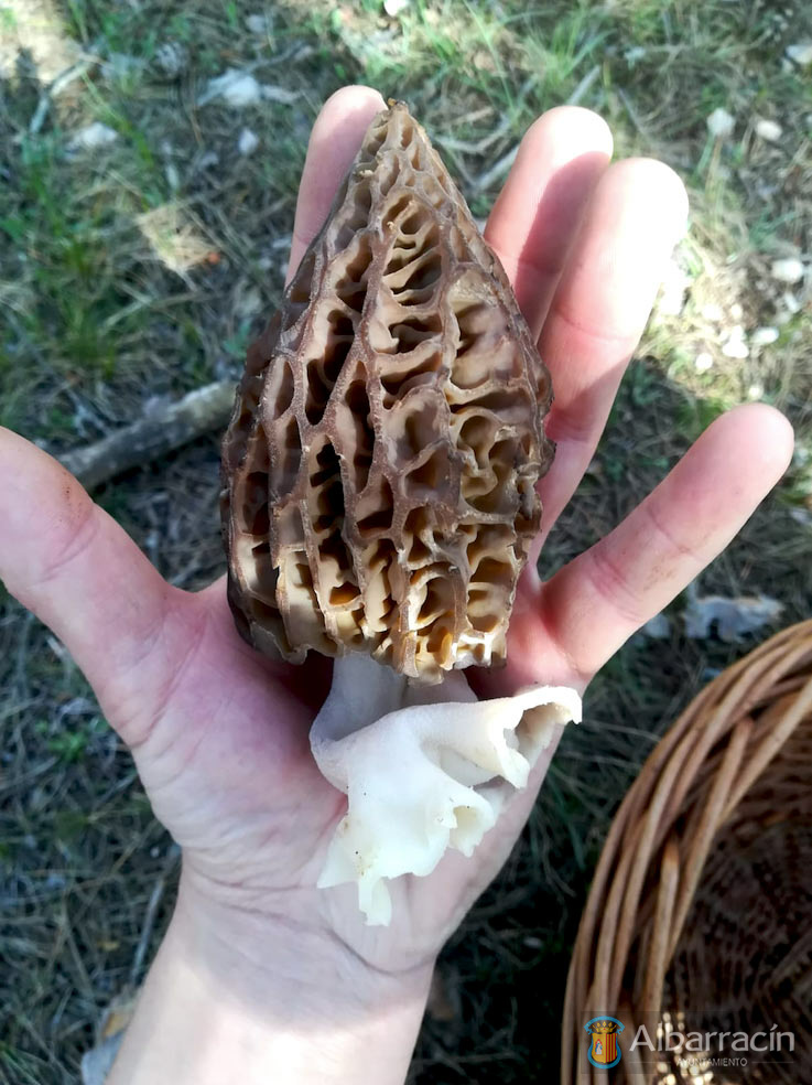
Spring · Main edible species: True morels (Morchella sp.), March mushroom (Hygrophorus marzuolus), Pine bolete (Boletus pinophilus), St. George’s mushroom (Calocybe gambosa), Chanterelle (Cantharellus sp.).
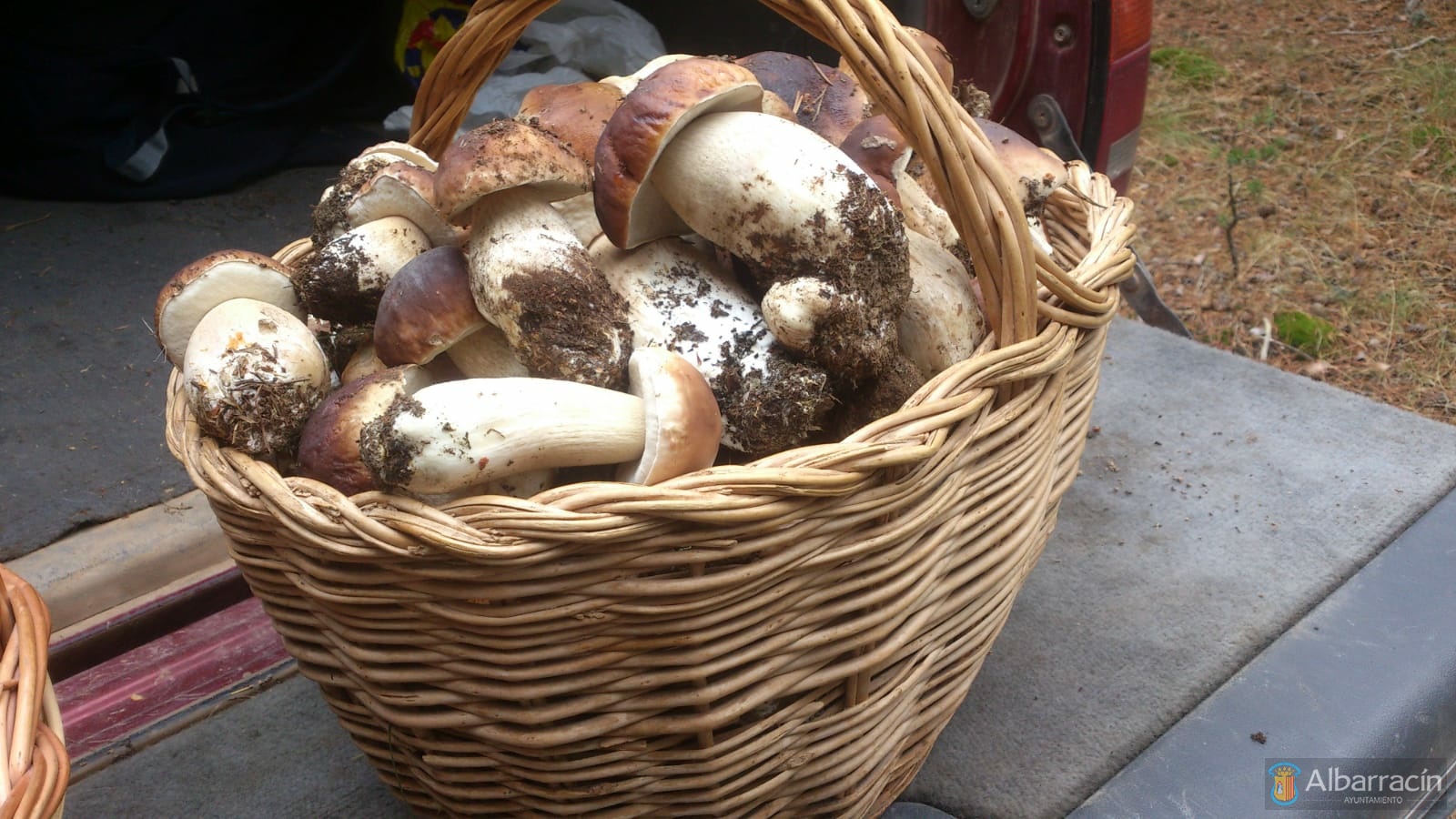
To enjoy collecting and eating the fungi from the Sierra de Albarracín inside the Mycological Park, you must purchase a harvesting permit, either for one day or for the whole season. Likewise, there are basic rules regarding vehicle traffic, security, surveillance and different recommendations to enjoy this natural paradise at the same time as respecting the surrounding natural environment.
You can find all the necessary information on picking mushrooms in Albarracín on the website: www.micorracin.es
Hunting in the Mountain Range
The over 45,200 hectares in the municipality of Albarracín boast around twenty game reserves – mostly municipal or sport reserves – and in addition, the noteworthy Montes Universales Game Reserve.
Given its size, the diversity of ecosystems that range from barren regions to dense forests of Scots pine with Pyrenean oak, and as it is an environment that has seen little human impact (the Anthropocene), Albarracín constitutes a physical and biotic paradise for wildlife in general and for big game species in particular, where, without natural predators, they need to be controlled by hunting to regulate their populations and avoid excessive proliferation.
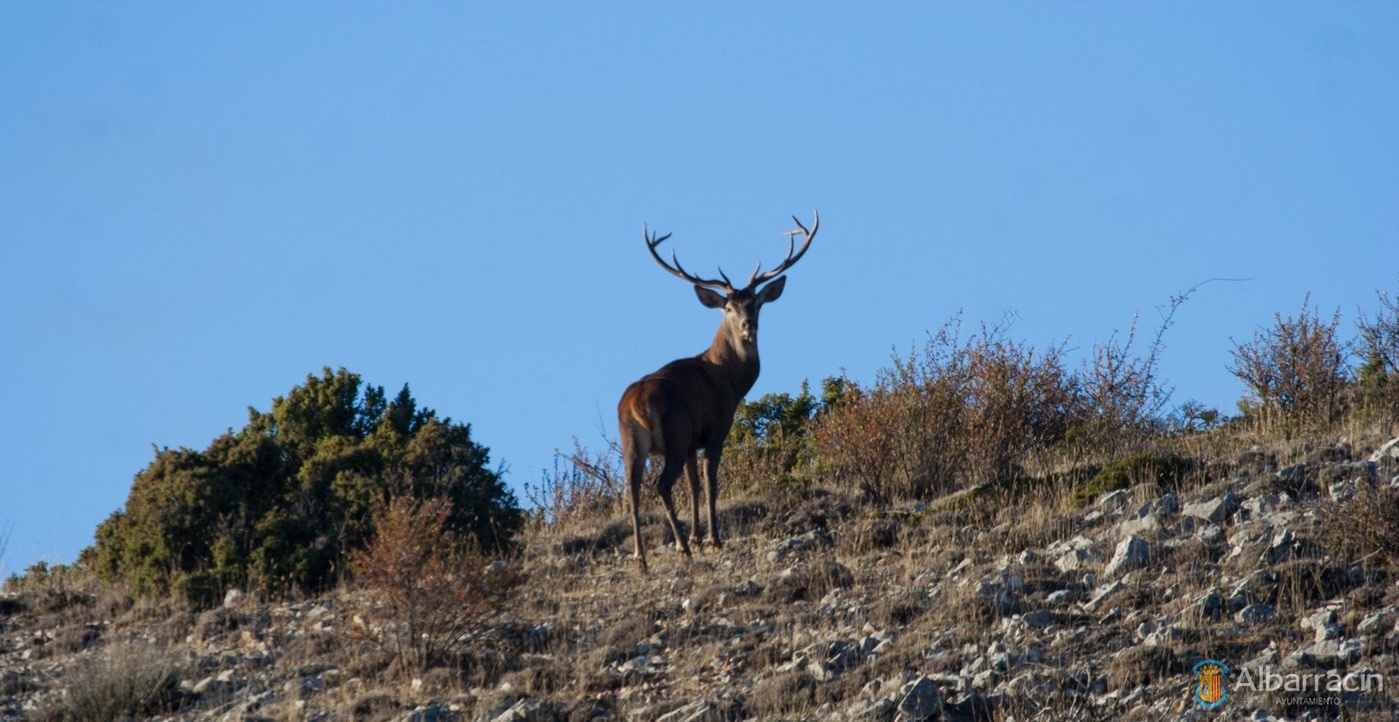
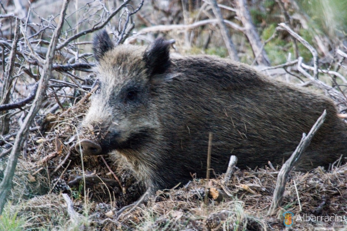
In the mountains of the City and Community of Albarracín, you can find almost all big game species of Aragon: wild boar, deer, roe deer, mountain goat and stags, with the only indigenous species missing being the sarrio or Pyrenean chamois. Moreover, small game species include: partridge, rabbit, hare, quail, doves, thrush and the woodcock.
‘Montes Universales’ Game Reserve
With an area of 49,778 ha, it was created in 1973 along with twelve other reserves nationally. Currently, hunting regulations in this reserve seek to protect, conserve, promote and use our hunting resources in an orderly way, guaranteeing their sustainability and compatibility with the conservation of other resources and uses of the natural environment; without prejudice to promoting, in turn, the socio-economic development of the municipalities that make up the area, which are listed below.
The municipalities that comprise the reserve are: Albarracín (10,698 ha), Orihuela del Tremedal (5,055 ha), Bronchales (3,687 ha), Monterde de Albarracín (1,920 ha), Torres de Albarracín (2,720 ha), Tramacastilla (2,488 ha), Noguera (4,759 ha), Griegos (3,721 ha), Guadalaviar (4,059 ha), Villar del Cobo (5,676 ha), Frías de Albarracín (3,005 ha), Calomarde (1,565 ha) and Royuela (425 ha).
Without a doubt, the red deer (Cervus elaphus) is the main game species found in ‘Los Montes Universales’, a renowned reserve due to the quality of its trophies. On the other hand, there is also a noteworthy selection of secondary game species, such as roe deer (Capreolus capreolus), wild boar (Sus scrofa), red partridge (Alectoris rufa), hare (Lepus granatensis), rabbit (Oryctolagus cuniculus), Eurasian woodcock (Scolopax rusticola), pheasant (Coturnix coturnix), fallow deer (Dama dama) and more recently, the mountain goat (Capra pyrenaica).
Finally, as a Game Reserve, its management corresponds to the Government of Aragón, which annually approves its Hunting Management Plan, which contains all the specific regulations, quotas for each species and their distribution. To access hunting permits, you need to visit the website aragon.es and search for ‘solicitud de caza en reservas y cotos sociales (request for hunting in reserves and social reserves)’; or, alternatively, you can contact the relevant city halls, who have permits to freely market.
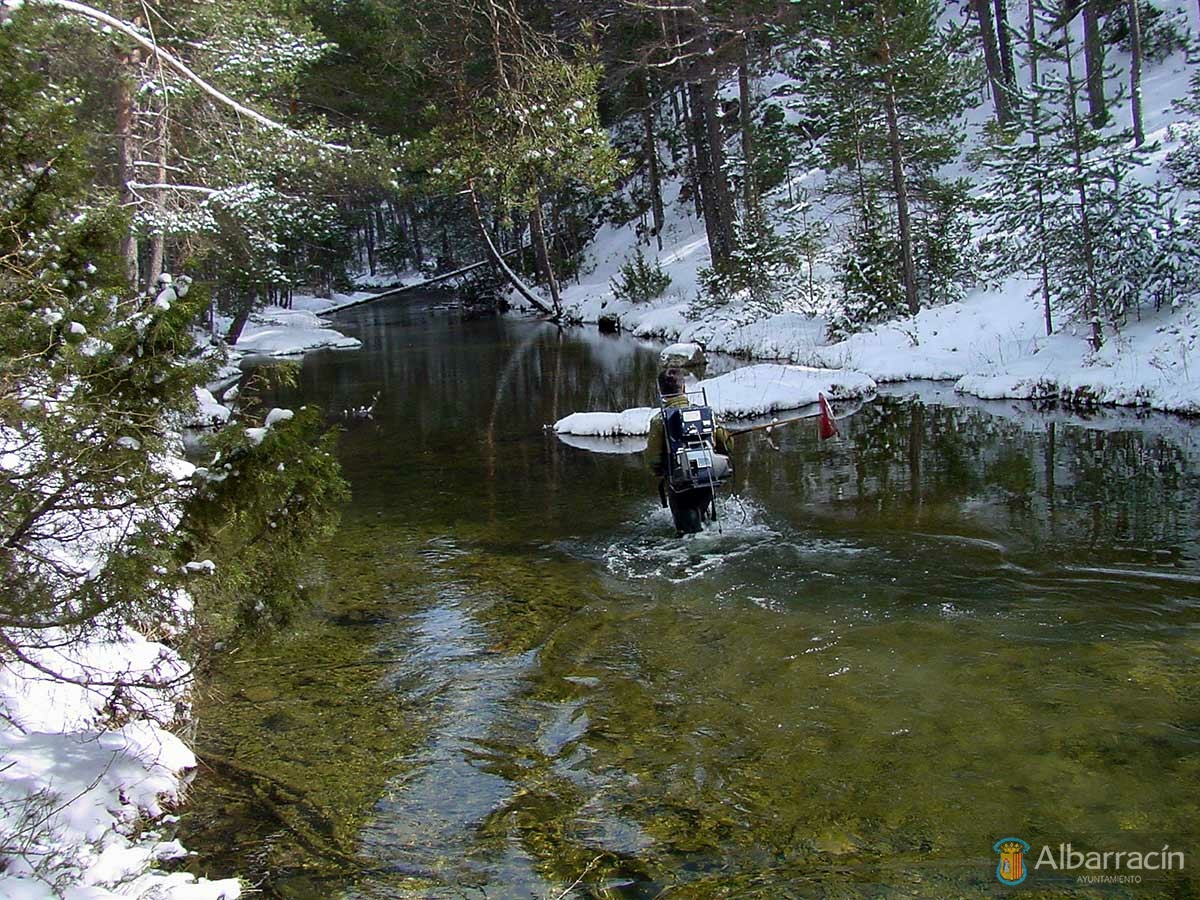
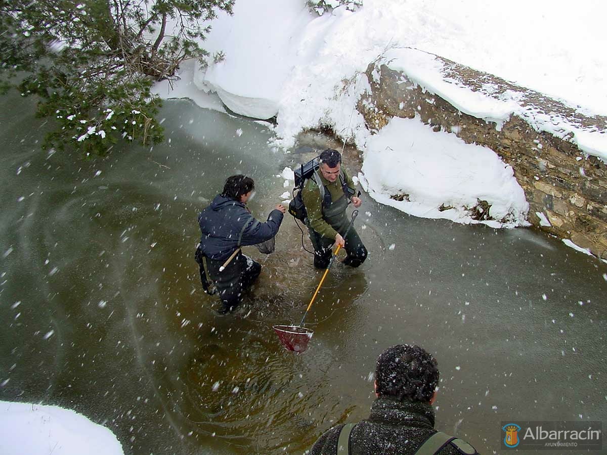
Fishing in the Mountain Range
There is a long-standing tradition of fishing in Albarracín, where annual fly fishing championships are regularly held. In this variety of catch and release fishing, a game or challenge is established between the fisherman and the trout, where sometimes the fisherman wins and sometimes the fish. In this scenario, the trout has the choice (whether to bite the fly, or decoy, or not), whereas the fisherman only has the option to offer it the fly or bait it is hunting at that time. In this context, and if the decoy or fly is not the right one, or not attractive to the trout, the fisherman will not catch their prey. Thus, the fisherman must first interpret the river and its surroundings and find out what type of fly will attract the trout in their sights.
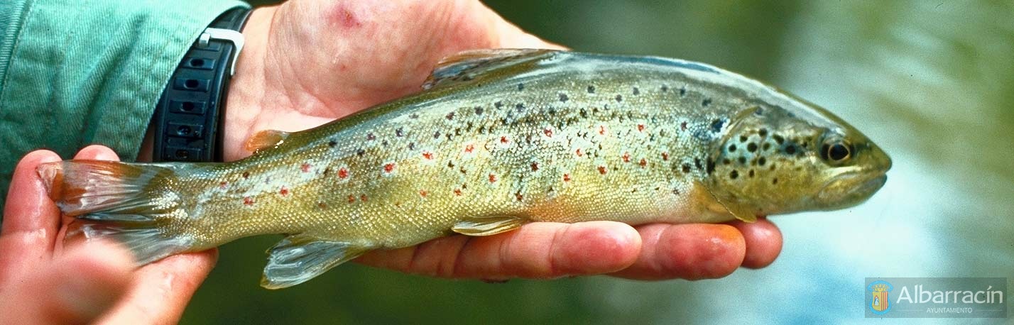
Albarracín and its Region boast unparalleled landscapes and river systems found in its three different watersheds: the Jucar, Tagus and Ebro rivers. This confluence of basins, or biogeographical singularity, together with other palaeogeographic and palaeoclimatic factors, has led to phenomena of local speciation, where most of the existing indigenous species are exclusive to their territory or river basins (endemic). Consequently, we can claim that our region is potentially one of the richest in terms of biological diversity – both plant and animal – and, in particular, in relation to the native continental fish species that it harbours (mainly the brown trout).
Thus, we possess mountain river courses of great relevance in the Iberian Peninsula; with the ‘Muela de San Juan’ confluence being most emblematic enclave, where the headwaters of the Guadalaviar, Cabriel and Tagus rivers meet. Similarly, the Sierra de Albarracín serves as a watershed for two of the three large watersheds of the peninsula: the Mediterranean and the Atlantic. The Guadalaviar river (Turia in Teruel capital), the Cabriel and the Ebron all flow towards the first, whereas the Tagus, and its tributary the Gallo, advance towards the Atlantic. On the other hand, there are also other ravines and tributaries that flow towards the Jiloca river, which forms part of the Ebro river basin, and in turn, the Mediterranean.
In short, with regard to river fishing, our region possess high-mountain rivers with clean and fresh water, which are ideal for our native varieties of the brown trout (Salmo trutta). According to a phylogenetic study in our rivers using mitochondrial DNA as a molecular tool, different native varieties of ‘Mediterranean’ brown trout have been detected in the Guadalaviar, Cabriel and Ebron rivers and their tributaries.
In addition, a unique indigenous ‘ATLANTIC’ variety of the common Aragonese trout has been identified, specifically in Aragon, in the source of the Tagus river and its high-mountain course; and in its tributary the Gallo river. This variety constitutes the only natural river reserve of the native ‘ATLANTIC’ brown trout in existence in our Autonomous Community, unlike the rest of the Aragón territory where different indigenous ‘MEDITERRANEAN’ genetic varieties have been described in rivers and tributaries of Mediterranean origin, which are legally part of the Hydrographic Confederations of the Ebro and the Jucar.
Finally, in the vicinity of the Albarracín municipality there are three social fishing areas on the Guadalaviar river and a free section on each of the Tagus, Cabriel and Guadalaviar rivers where you can practise ‘catch and release’ trout fishing. To obtain permits for social reserves and to get updated information on the regulations and geographical boundaries of each section, check the Government of Aragón website in the section ‘Pesca en Aragón’ (Fishing in Aragón).
Additional material: Conservation of the Trucha Común Aragonesa (Aragonese Brown Trout)
Video: Fly Fishing in Albarracín
Bees and Other Pollinators
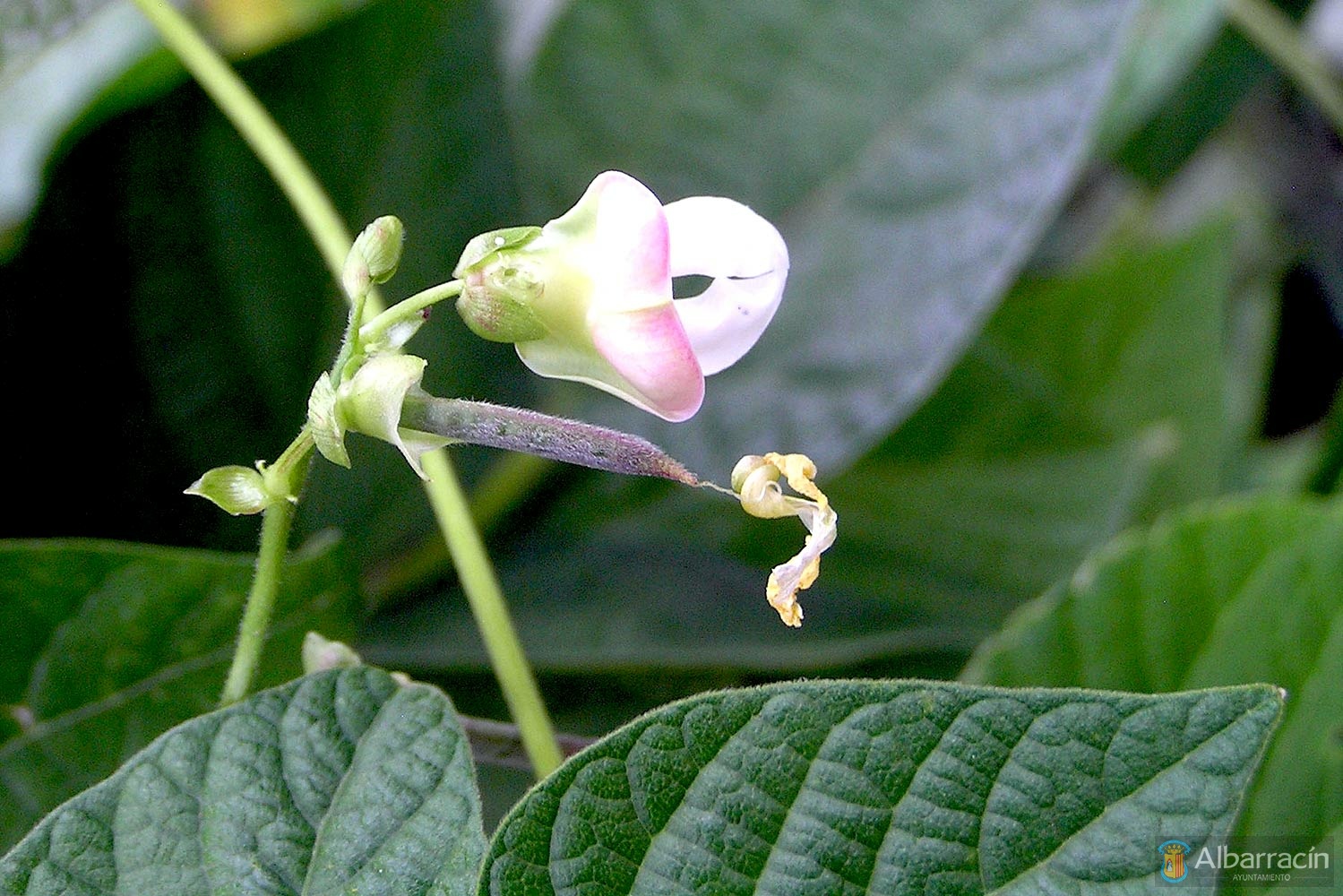
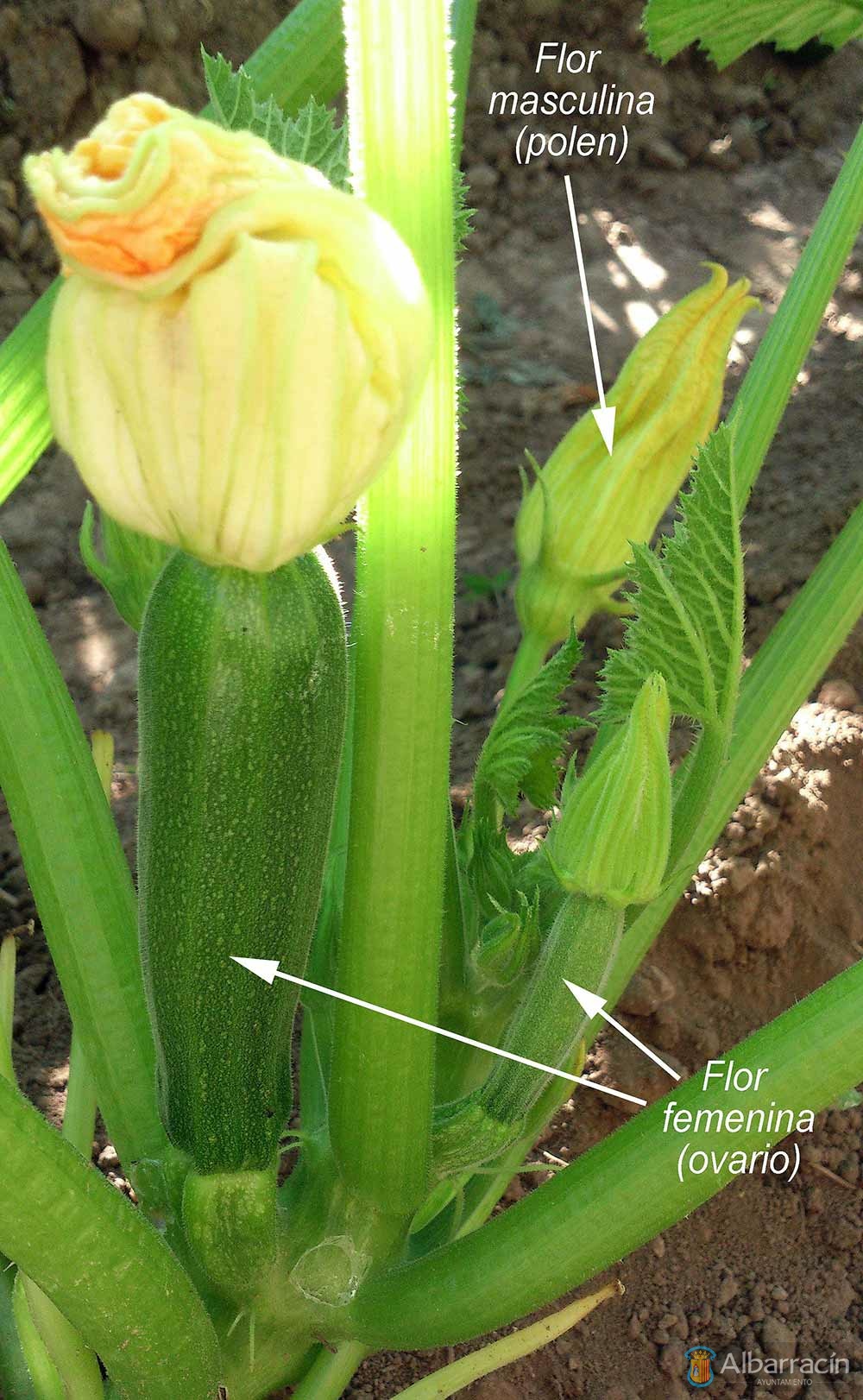
Bees and other pollinators are animal vectors (primarily insects) that transfer pollen from the anther (male organ) to the stigma (female organ) of the flowers of angiosperm plants for fertilisation or fusion of gametes – that is, the pollen grain with the female ovum – thus ensuring the reproductive function and development of berries and wild fruits for the maintenance and propagation of much of our extraordinary plant biomass in la Sierra de Albarracín. In addition, in the field of agriculture and food, more than three quarters of our vegetable crops – fruit and vegetables – depend on vector mediated pollination.
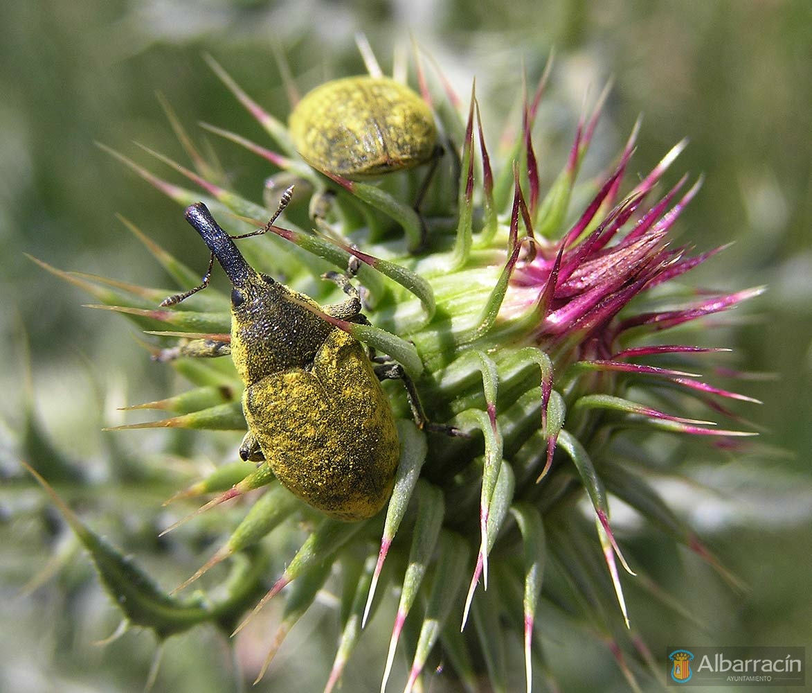
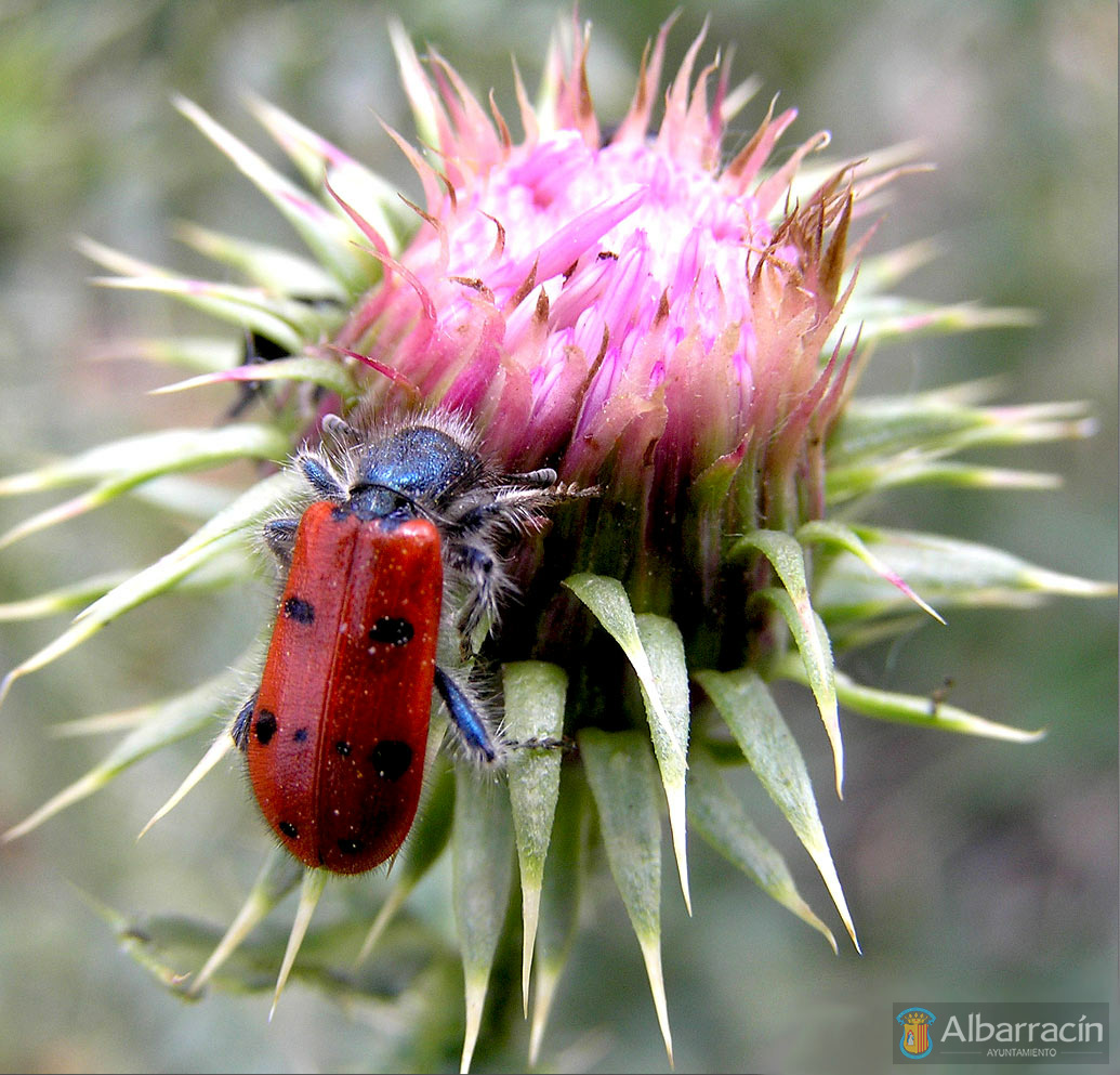
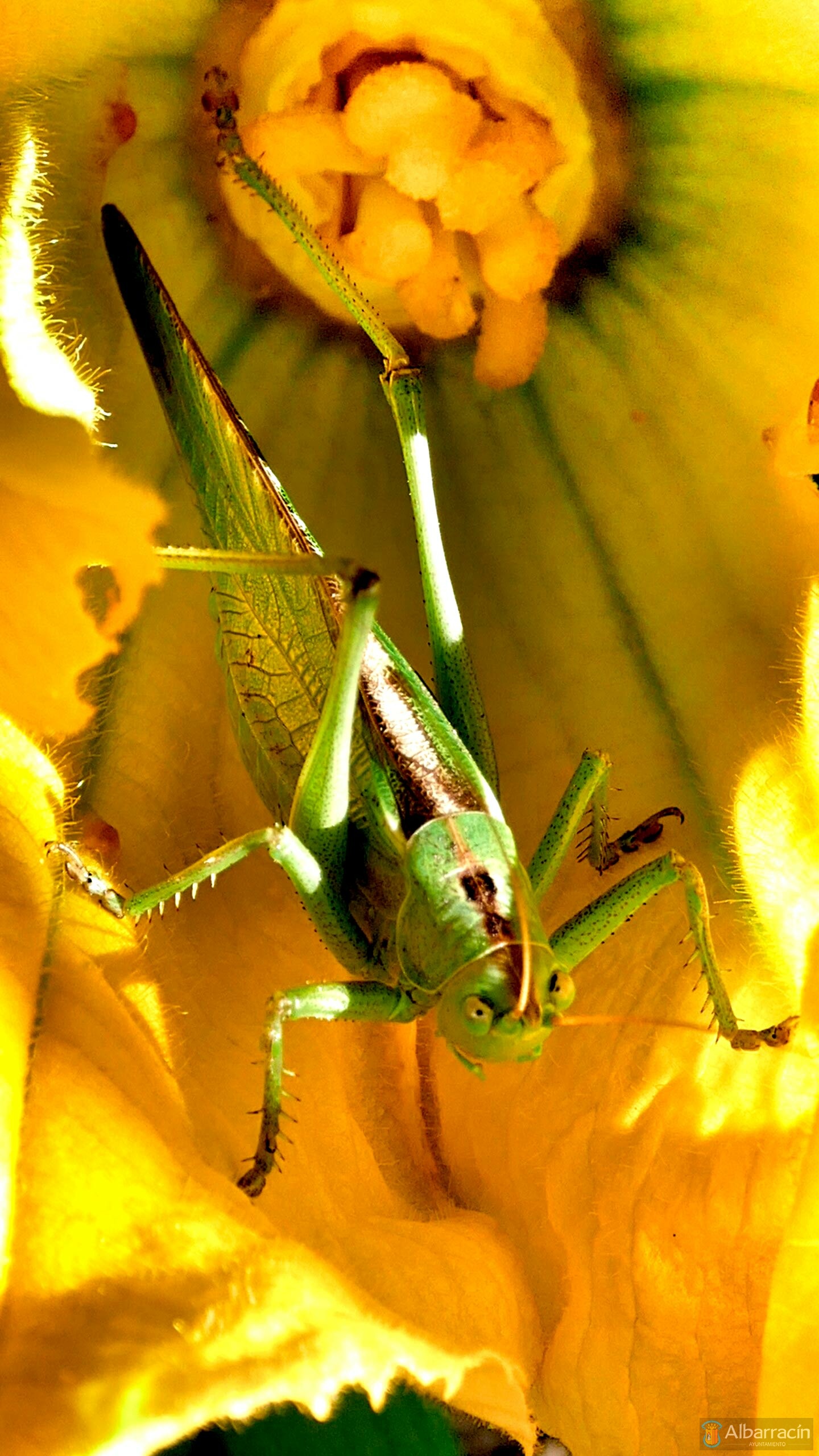
As mentioned above, most pollinators are insects belonging to four reference orders: 1) hymenoptera (bees, wasps and ants), 2) diptera (flies and mosquitoes), 3) lepidoptera (butterflies and moths) and, finally, 4) coleoptera (beetles).
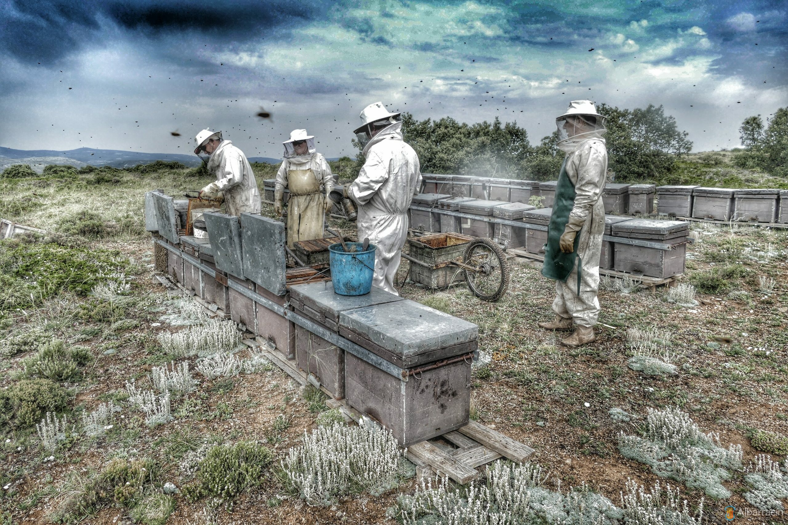
Bees in the Sierra de Albarracín
Bees fulfil an extraordinary underestimated environmental function through the pollination or fertilisation of flowers that contributes to the modelling, maintenance and regeneration of our plant biomass by favouring the fruit-bearing and production of wild and cultivated seeds. Thus, they pollinate more than 200,000 species of flowering plants (angiosperms) and their foraging area can reach up to 10 km, which represents a potential area of activity of about 31,400 hectares.
“The main treasure that bees offer us is the pollination and health of our mountains. Honey, pollen, royal jelly and wax are secondary treasures.”
Similarly, bee pollination in agriculture is, in turn, underestimated. It is well documented that good pollination of crops will yield optimal fruit production (symmetry, size and sugars) and quality seeds (quantity, oil concentration and germinative capacity).

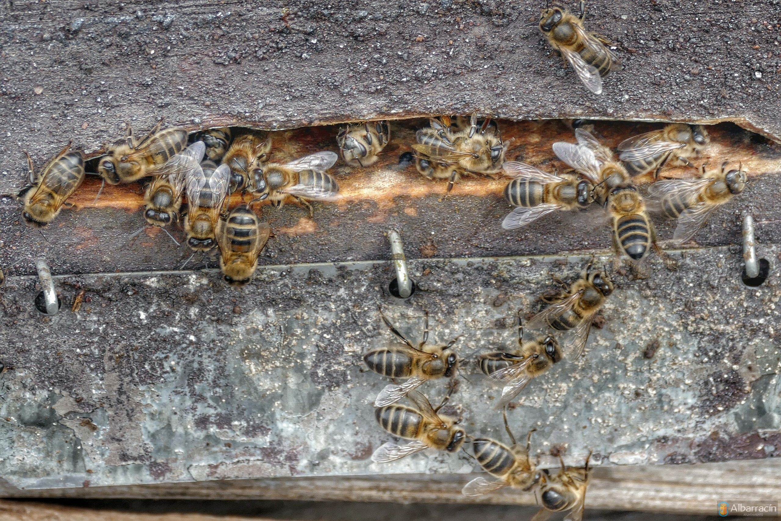
Thus, our abejas melíferas or honey bees are, par excellence, the most efficient pollinators thanks to their physiological adaptations for collecting pollen and extracting nectar and, in this way, feed their young in the hives that pepper our Mountains of Public Utility (MUP by the Spanish acronym) in this mountain range. In this way, they visit many flowers per unit of time and show great loyalty to the plant species they are searching for on each flight. On the other hand, there are also numerous flowers in the environment that have adapted and that lure worker bees for foraging or visits thanks to their aromas (chemical messengers), colour and/or design or form. We can therefore speak of a co-evolution mechanism or concerted evolution of both species derived from patterns of mutual selective pressure.
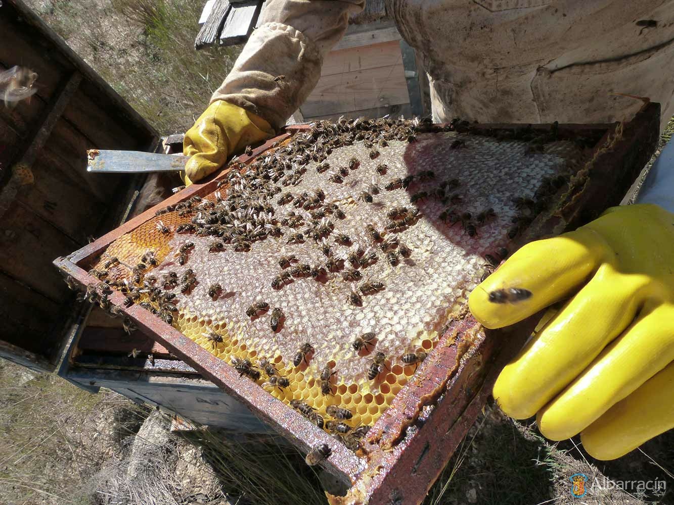
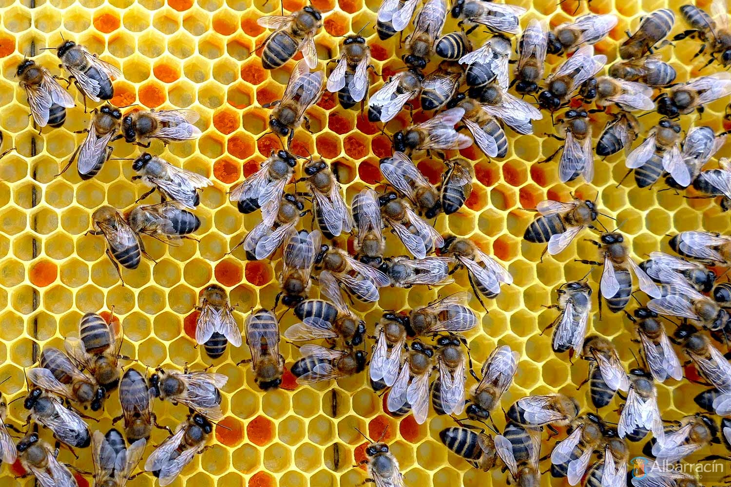
The worker bees that ‘collect’ nectar, pollen, water and resins start their tasks at three weeks old and their longevity will depend on their activities or flight hours (four or five days in peak flowering periods). For this purpose, they have a tongue and sucking apparatus adapted to lap and suck nectar and a hind leg modified to transport pollen and resins (pollen basket). In turn, they develop an exquisite orientation and navigation system based on visual (odometer), magnetic and olfactory indications; they also have a prodigious ability to learn and memorise colours, shapes, fragrances and flight routes.
Curiously, a few collector worker bees from the group will be more prone to searching for adventures – the ‘scouts’ – and will devote themselves exclusively to searching for new sources of food (flowers) and communicating the locations to their beehive congeners through ‘waggle dances’ in the hives.
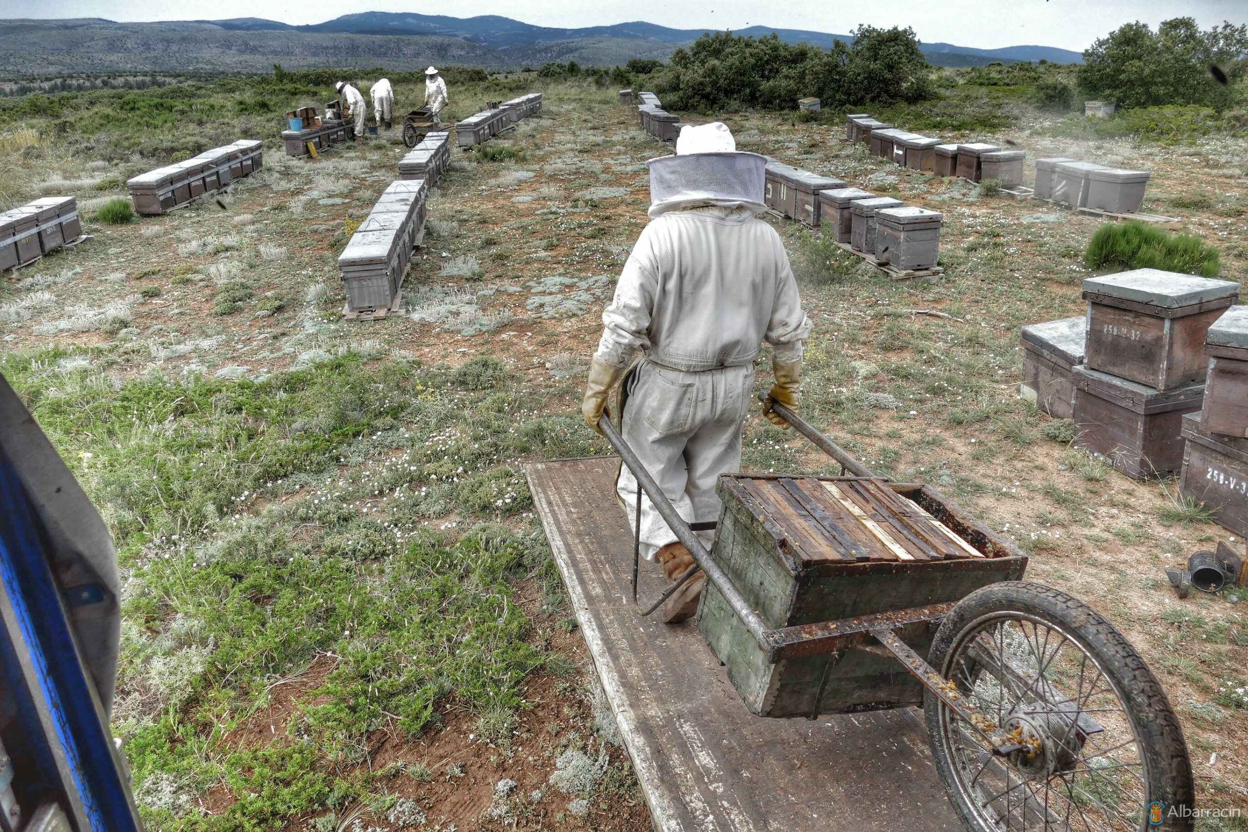
Hive Management Systems in the Region
Honey collection and bee-keeping are thousand-year-old trades that have their universal icon in a rock painting in Bicorp (Valencia), dated to about 7,000 BC, and which is part of the Rock Art of the Mediterranean Basin declared a World Heritage Site by UNESCO in 1998; and, more recently, in another manifestation discovered in Castellote (Teruel), dating to a similar age and of an extraordinary quality, which reproduces another scene of honey-collecting by a hominid up a ladder.
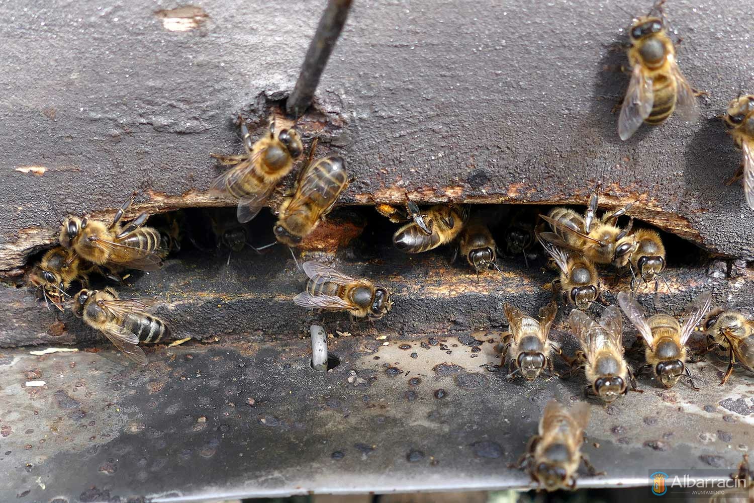
At present, and in the flowering season in our mountains, more than 50 bee-keepers gather care for a total of 5,000 to 6,000 hives, the majority of which are nomadic (79%) as opposed to fixed comb hives (21%). These figures represent approximately 1.3 hives per inhabitant in the Region and 3.9 hives per square kilometre of area, with an estimated total honey bee population of about 165 million (assuming an average of 30,000 bees per hive).
Consequently, the honey bee community in our entire Region – that is, in the 25 municipalities with 52 Mountains of Public Utility (MUP) and a forest biomass area of almost 94,000 ha – is very relevant and ensures good pollination and health of our forests and associated agricultural crops. In fact, the hive count mentioned above is distributed over more than two-thirds of the municipalities of our mountain range, which allows all of our plant biomass to be reached thanks to the extraordinary foraging radius of the worker bees.
Finally, and with regard to the production of honey (blends and types), the nomadic hives will produce more harvest by being migrated in the autumn to warm Valencian lands (thyme and holm oak myelates); and, on the contrary, the single-harvest fixed hives (multi-flower honey) must have enough reserves to thermoregulate and survive the Sierra’s harsh winters.
Forest Heritage
Forest Heritage
The forest heritage of the Sierra de Albarracín is vast and extraordinary and is limited to 52 Mountains of Public Utility (MUP) with 93,763.35 ha of total surface area, of which 78,646 ha are publicly owned, that is, they belong to the town councils and the City and Community of Albarracín.
There is an entity of great importance, the City and Community of Albarracín, which owns 14 of the aforementioned MUPs, which total a public area of 35,128.61 ha; this ultimately makes it the owner with the largest wooded mass area in the province of Teruel. Of the entire area, Albarracín City Hall is responsible for just over half – 52.17% of the total, about 18,327.97 ha – which, together with two other owned MUPs, totals 19,107.35 ha.
In fact, both the Albarracín City Hall and the Community of Albarracín are unconditionally aligned with the promotion and sustainable use of ‘forest biomass’ as a renewable energy source in our territory, promoting the recycling of waste, the improvement of the quality of forest mass and, in turn, minimising the risk of fire. Thus, both institutions are potentially eligible to implement strategic environmental transition projects based on these biofuels (mainly wood chips) in a ‘circular economy’ model that is an alternative for responsible saving and investment.
To this end, and through our forest management plans (POM by its Spanish acronym) and the principles of sustainable forest management – Programme for the Endorsement of Forest Certification (PEFC) – managed and sustainable timber harvesting is carried out which does not compromise the forest mass or its associated ecosystems in any way. In fact, all of our POMs permit higher intensity timber production, as harvesting levels are a long way off from exceeding the replenishment rates of our forests. It should therefore be noted that compliance with the DNSH (‘do no significant harm’) principle for the objective of climate change mitigation is guaranteed, as well as the ‘eco-efficiency’ of our energy strategy (that is, the renewable source of the energy resource – forest biomass – and its self-sufficiency – existing POMs).
It should be stressed that the regulated tree felling in our POMs – carried out for improvement and regeneration – is essential for the manageable and sustainable growth of the tree mass; far from the false belief that only diseased or old trees should be cut down. These regulated cuts improve the productive capacity of the forest and therefore also its atmospheric CO2 fixation capacity. On the contrary, to exploit only a small part of the forest’s productive capacity means reducing growth and timber productivity and that, progressively, the forest mass will shift towards general collapse, with its CO2 absorption capacity diminishing, becoming an old, depleted tree mass that is unable to regenerate. Consequently, the failure to execute this felling, far from being a ‘conservationist’ attitude, implies, on the contrary, a loss of current and also future income.
For all these reasons, the Albarracín Town Council and the Community of Albarracín wish to highlight once again the exploitation of timber in the MUPs under their control; and, in this regard, they wholeheartedly support the opportunity to use their forest biomass as a source of renewable energy for heating purposes, encouraging the design of ‘biomass heat networks’ in the territory. In this regard, in 2021, 12 timber lots from different proprietary MUPs were put out to tender and awarded, obtaining a revenue of € 255,472.34. This amounted to just over 14,000 m3 of quality sawmill timber with an equivalent weight of 10,000 tonnes from 10 lots sold. Similarly, two smaller lots were also awarded with lower-quality common pines and resin pines with a yield of 190 tonnes.
In short, it is clear that the timber potential of the Albarracín City and Community-owned MUPs is more than sufficient for the production of quality sawmill timber; as well as for the production of biomass for heating purposes (wood chips, mainly) from waste and batches of inferior wood – even more so, when the POMs of most of our Mountains of Public Utility allow for increased harvesting intensity. Therefore, the sustainability of our energy policy is unquestionable.
Finally, our citizens applaud the initiative proposed as it involves a significant mobilisation of our timber resources – which have been very depleted in recent decades – and, in turn, for not abandoning the natural evolution of our forest mass to its fate, which would ultimately be advancing towards a collapse and progressive ageing of the mountain, with an accumulation of biofuel creating the perfect conditions for forest fires. It also embraces the idea that ‘biomass heating networks’ conform to a ‘circular economy’ model by using our native wood (principally wood chips) for thermal purposes (heating and ACS).