GR 10
The GR 10 is accredited as a Tourist Hiking Path of Aragón, a long-distance hiking trail that runs between Portugal and Valencia. In Aragón it leads you through the Iberian System, covering the massif of Javalambre, roof of the province of Teruel, with Javalambre Peak (2020 m) and Los Montes Universales mountains. It brings you to the important examples of Levantine Rock Art of the Sierra de Albarracín, declared a World Heritage Site, to the beautiful landscapes of the Protected Landscape of Los Pinares de Rodeno, with monumental pines and myelates, ravines, gorges and rocky escarpments, a natural picture of outstanding beauty. It shares the route with the E-7 European long-distance trail that connects Portugal to Romania, crossing Aragón from east to west thanks to the union of GR 8 and GR 24.
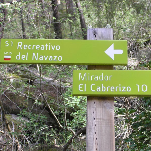
GR 10 · Stage 8 / Bezas – Albarracín
A long and highly attractive hiking stage that crosses the Protected Landscape of the Rodeno Pine Forests. At its start, the GR 10 goes up the Las Tajadas or Dornaquejos ravine, with a link to the cave paintings, and reaches the Dornaque Interpretation Center (visit recommended). Go up trails between sandstones to the Alto del Puerto viewpoint and then descend again to the cave paintings of Prado del Navazo and the visitor reception center, where you can access the many shelters with cave paintings. Finally, it descends through the Cabrerizo ravine, connecting with the PR-TE 5 path to Saldón, until it ends at the road, near the Arrabal de Albarracín neighbourhood.
Information provided by the Government of Aragón at www.turismodearagon.com
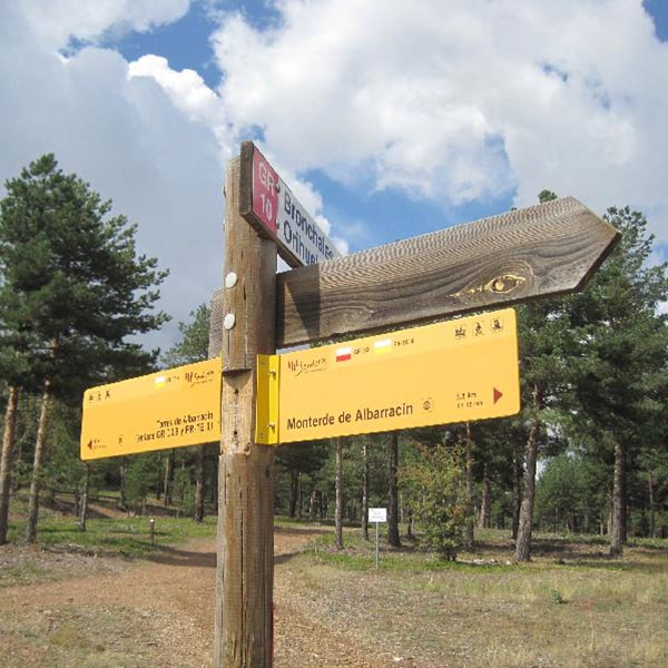
GR 10 · Stage 9 / Albarracín – Monterde de Albarracín
The GR 10 to Monterde starts in the El Arrabal de Santa Bárbara neighbourhood (c/ Vuelta Corta). It reaches the bridge over the Guadalaviar river and runs along the right riverbank. Further on, it crosses another bridge and reaches the Los Rubiales industrial estate. A dirt road that later turns into a path climbs a hill where it links up with a forest track. After successive crossings, the itinerary crosses the track on several occasions until leaving it along a grassy track that leads to San Cristobal hill, from where Monterde is visible. The descent to the town is via a stony path, which turns into a paved trail later on.
Information provided by the Government of Aragón at www.turismodearagon.com